




Ask three suppliers how far a base station can be from its rovers and you will usually get three numbers, all stated with more confidence than the physics supports. The honest version: there is no fixed RTK base station range. There is a budget, and it is spent in three places — baseline length, the correction link, and the sky view at both ends.
This is written from deployment experience rather than from a datasheet: how the error actually grows with distance, why the radio link gives out long before the algorithm does, and the checks we run before committing a base station to a site.
RTK Base Station Range: How Baseline Length Costs You
The headline first: on a quiet day, distance itself is cheap. It is the ionosphere's bad days that set the real limit.
RTK accuracy is quoted in two parts, for example 2.5 cm ± 1 ppm. The first number is what you get up close; the second grows with the baseline. One ppm is one millimetre per kilometre, so the arithmetic looks almost free: 10 km of baseline adds about 1 cm, 20 km adds about 2 cm.
| Baseline | RTK spec 2.5 cm ± 1 ppm | What actually changes |
|---|---|---|
| 1 km | ~2.6 cm | Nothing; fixes come fast and hold |
| 5 km | ~3.0 cm | Still routine |
| 10 km | ~3.5 cm | Initialization takes longer on some days |
| 20 km | ~4.5 cm | Fix availability becomes the real issue |
The catch is that the ±1 ppm term describes normal ionospheric conditions. The atmosphere is what makes RTK work at range: a base station at a known coordinate measures the current atmospheric delay and the rover subtracts it, but the atmosphere over the rover is not quite the atmosphere over the base. The further apart they are, the less that correction means. On ordinary days the residual is the millimetre-per-kilometre floor in the table. During ionospheric activity the error between the two ends stops being predictable, fixes take longer to close, and rovers that held a fixed solution all week start floating. That is why seasoned crews in mid-latitude sites treat roughly 10 km as the comfortable working radius for centimetre work, and plan redundancy beyond it — not because the rms doubles, but because the fix rate quietly does not survive the bad days.
The Correction Link Fails First
In practice the distance limit is almost never the GNSS error budget. It is whatever carries the corrections, and it fails in boring ways.
A UHF radio link is the classic choice: no recurring cost, millisecond latency, and a range that depends almost entirely on terrain and antenna height. Over open ground with clear line of sight, tens of kilometres are achievable. Put a hill, a warehouse row, or a tree line between base and rover and the same link may not hold 2 km. Range figures quoted for radios are line-of-sight figures; a site is not.
A 4G link with NTRIP removes the terrain problem entirely — the corrections travel the cellular network, so the baseline can be 50 km and latency still under a couple of seconds. The new dependencies are coverage and data: dead zones become dead correction zones, and a roaming SIM is now part of the positioning budget. This is the trade-off behind choosing your own base versus a correction method altogether, which we compared in more depth in RTK versus PPK.
| Link | Realistic reach | Latency | Watch out for |
|---|---|---|---|
| UHF radio | 2–10 km typical; more with true line of sight | Milliseconds | Terrain, antenna height, local licensing |
| 4G + NTRIP (own base) | Wherever coverage exists | 1–3 s | Dead zones, SIM/data cost |
| CORS subscription | Network density, not your hardware | 1–3 s | Recurring fee, nearest station may be 20+ km away |
Latency deserves its own sentence: RTK corrections tolerate a few seconds of age well, degrade noticeably past that, and most receivers drop to float when corrections stop arriving. A link that delivers today's atmosphere ten seconds late is, for RTK purposes, not delivering.
Where the Base Sits Matters More Than How Far It Reaches
A mediocre antenna position inside a 5 km radius will outperform a perfect receiver on a bad position at 15 km. Three placement habits decide most deployments.
Sky view comes first. The base needs the same clear horizon discipline you would demand of a rover, plus more, because its errors are now everyone's errors. A rooftop corner with a wall to the south bakes multipath into every correction it broadcasts — and there is no algorithm downstream that separates a reflected signal from a real one, a problem we covered in urban multipath mitigation. On a choke-ring or geodetic antenna the environment is the product; the options are in high-precision and choke ring antennas.
Geometry comes second. If the rovers work one side of the site, placing the base at the centroid of the work area — not at the site office, which is where convenience puts it — shortens every baseline at once. The measured antenna height must be entered correctly, and as a true vertical or slant per the software's convention: a slant measured as vertical is a straight position error shared by every rover on the link.
Power and uptime come third. A base that reboots when a generator cycles takes every rover's fix down with it, and re-initialization at range is slow. Backup batteries and watchdog behaviour are not accessories at range; they are the difference between a network and a fair-weather demo.
Three Misjudgments We Keep Seeing
None of these show up in a bench test. All of them show up in month two.
- Buying range instead of building it. The single biggest lever on radio range is antenna height at the base, not transmit power. Two metres more of mast routinely beats a "longer range" radio.
- Trusting the fix indicator at distance. At 15–20 km, a rover can report a fixed solution that is drifting between epochs. Log the fix rate and the standard deviation over a full day, not the five-minute walk test near the truck.
- Ignoring the rover half of the budget. Channel count, multipath handling and antenna quality at the rover decide how much of the base's potential range is usable. A weak rover shortens an otherwise sound network, which is why we spec base and rover families together — see surveying RTK rovers.
Hardware for the Base End of the Link
When a crew asks us what to put at the base end, the answer depends on whether the base moves between projects. Both of the parts below have done duty at the centre of working networks: one as a self-contained unit that relocates in minutes, one as the receiver at the heart of a fixed installation.
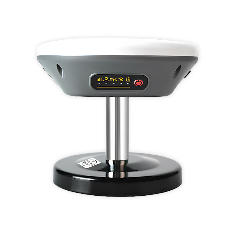
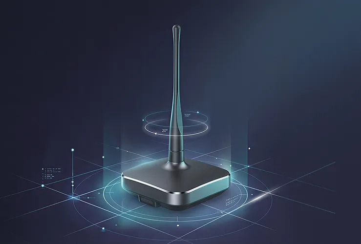
X11 — All-in-One RTK Smart Antenna
- RTK 2 cm ± 1 ppm; PPP ≤50 cm static
- 5200 mAh internal battery, up to 10 h untethered
- 4G Cat.1, BLE 5.2, custom radio link option
- IP66, 122 × 122 × 43 mm, 9–45 V DC input
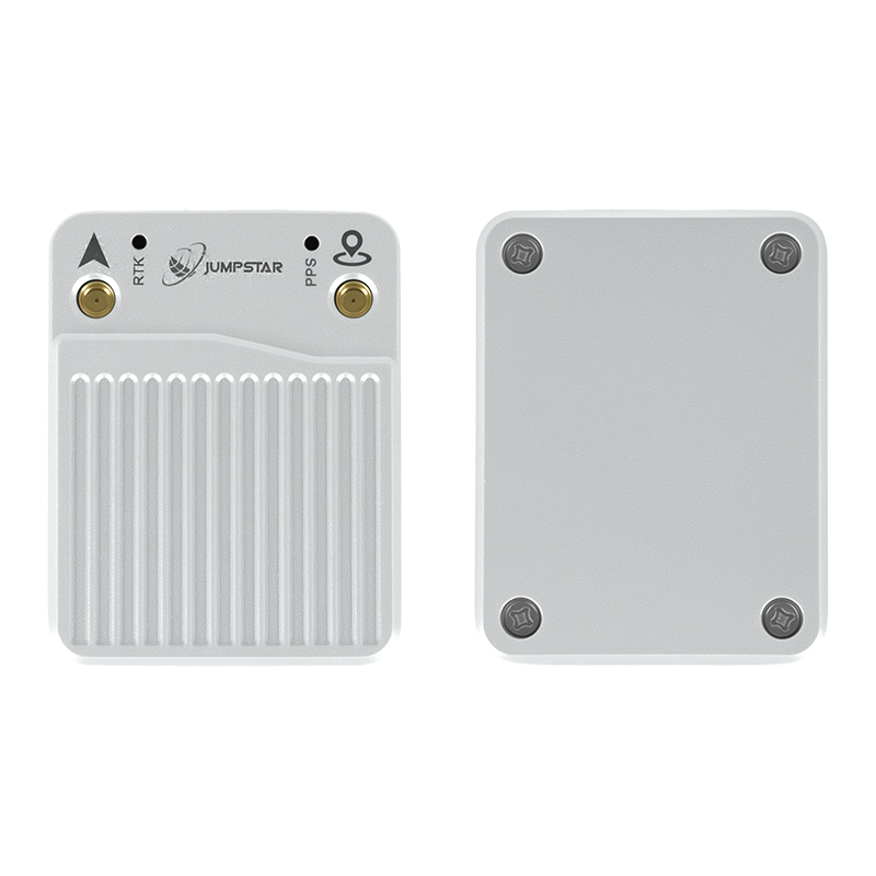
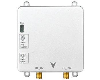
X43H-AH — RTK Receiver Board
- RTK H 0.6 cm + 0.5 ppm; 789 channels
- Heading 0.15° / 0.03° at 1 m / 5 m baseline
- AIM+ anti-jamming, OSNMA anti-spoofing
- 43.8 × 34 × 11.5 mm, −40°C to +85°C
For permanent installs where heading is not needed, the X28 multi-band smart antenna (2.5 cm ± 1 ppm, LoRa link up to 1000 m, IP67) covers base duty in a 143 mm ASA housing, and the P-Box-X10 receiver adds 100 Hz raw output for custom integration. The rest of the base-station family is listed under GNSS base stations, and the siting practices above are expanded in our RTK GNSS best practices.
How to Verify Range Before You Commit
Every site argues with the general rules, so measure instead of assuming. Three checks settle it in a day.
- Fix-rate profile. Station rovers at 2, 5, 10 and (if relevant) 20 km on the actual work routes, and log fix rate plus standard deviation for a full working day each. The distance where fix rate drops below the low nineties in percent is your working radius, whatever the brochure says.
- Bad-day sample. Repeat the longest baseline once during forecast ionospheric activity. If initialization time triples, that baseline needs a closer base or a redundant link, not tuning.
- Link audit. Log correction age at the rover across the whole site. Dead spots on 4G and shadowed radio paths show up here months before anyone connects them to a positioning anomaly.
Questions Buyers Ask Most Often
How many rovers can one base station serve?
On a radio link, effectively unlimited — the broadcast does not care how many receivers listen. On NTRIP the mountpoint handles concurrent connections in the dozens; the practical ceiling is link bandwidth, not the base hardware.
Is 30 km of baseline realistic for centimetre work?
Intermittently, yes; reliably, no. On quiet days the geometry closes and the fixes come. When the ionosphere is active the same baseline floats for minutes. Crews who must work through those days put a base inside 10 km or accept a degraded schedule.
Do we need dual-antenna heading at the base?
The base does not need it; rovers that operate at low speed or standstill often do. Heading is a rover-side question — how it is derived from a second antenna is covered in dual-antenna RTK heading.
Own base or CORS subscription?
A subscription buys coverage tomorrow with no hardware; a own base buys fixed geometry, no recurring fee and full control of siting. Operations confined to one site with centimetre tolerance almost always end up cheaper with their own base; dispersed or mobile work often justifies the subscription. Both can coexist — many fleets run a local base where they cluster and fall back to network corrections elsewhere.
RTK base station range is not a number on a datasheet; it is a property of your site, your link and your schedule. If you share the work area and tolerance, we can tell you where the budget actually goes — and where it does not. For the measurement side of the same question, our surveying and mapping applications go into field workflow in more depth.
Planning a base-and-rover network?
Tell us the site size, terrain and the tolerance your work actually needs. We will help you size the baseline, pick the link, and spec the base end to match.
.jpg?imageMogr2/format/webp)
.jpg?imageMogr2/format/webp)
.jpg?imageMogr2/format/webp)